Road Segmentation in Aerial Imagery
·994 words·5 mins
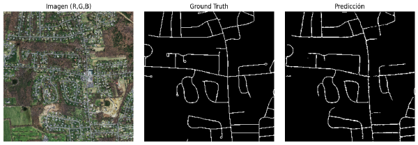
Project Summary # A road segmentation system for high-resolution aerial imagery is developed using a subset of the Massachusetts Roads Dataset. The project combines classical feature engineering with a semantic segmentation U-Net model, including quantitative comparison (Dice, IoU) against non-deep learning approaches.